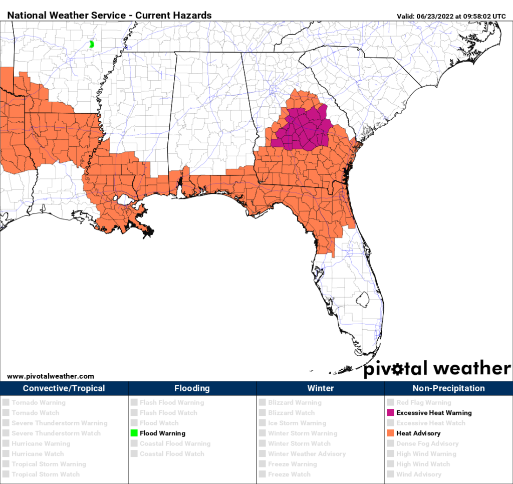
Well, as the title might suggest, we are looking at a bit of a pattern change coming up. It does seem like the summer heat is here to stay, as has been discussed several times over on this site. A Heat Advisory is in effect for areas along and West of US 49, including Hattiesburg, Prentiss, and other areas in Southern Mississippi colored in orange below.

This heat advisory will end at 7pm tonight, and the NWS has not yet decided on extending it, so today is the only day currently covered by heat statements. Potentially dangerous heat will likely continue through the weekend, though, and more advisories will probably be needed.
The map below is the NAM forecast for heat indices for tomorrow at around 3pm. With heat indices around 105 for a good chunk of the area, plan on taking breaks in the shade and staying hydrated. Your usual summer stuff. The red dots you see are actually thunderstorms that are cooling off the air, that is the best chance for relief we’re going to see. As the model suggests, the best chance of thunderstorms tomorrow is going to be South of Hattiesburg, so for areas like Meridian or Laurel, MS, it’s more likely that you’ll stay dry (and hot).

Since the ridge is slightly displaced to our West, we’re going to be seeing Northerly flow into our region. Similarly to last week, the humidity levels will drop, except not quite as much. It will be drier, but honestly it isn’t quite as strong of a difference. Instead of our air coming in from Canada, it’s moving into this region from the Midwest, which is pretty humid this time of year. It still will be hot. At this point in the year, there isn’t much way to get around the fact that it will be hot every day, so that is not going to change soon.
As the ridge continues to sit over the region, the heat and humidity will more or less be continuing through the weekend. The ridge’s exact placement will determine the conditions for the day.
The main ridge is forecast to move out towards the West. Two important things usually happen with this pattern:
- Western ridges usually mean cooler weather can enter into the Eastern US
- Usually, storms will form along the edge of the ridge and move along the edge, to the Southeast (Seen in red below)
This may not be so applicable for us this time, though. Although the center of the ridge is set to be over the Mountain West by the middle of next week, a portion of the ridge still remains over our area (The blue jagged line represents an “arm” of the ridge over us). So, even though the worst of the high pressure is far away, it still is going to influence our weather.

I do have some good news though! In my last post, I addressed the possibility of a drought. While this is still possible, it looks like afternoon storm chances will increase. Since the center of this upper level ridge is further away, it will have a harder time suppressing rain chances here in the Southeast. The usual summertime storms are going to start coming back, after a relatively dry week.
The drought monitor is updated Thursday mornings, so check out the latest update here. This drought map below is for the last week, but it won’t update in time for me to post it here, unfortunately. No real drought conditions have formed yet, but the yellow represents abnormally dry conditions, which we have definitely seen.

The Weather Prediction Center (WPC) is forecasting around 0.5”-1” of rain across the area over the next week, especially focused on the Southern half of the forecast region. Not a lot of rain, but hopefully enough to help water some of the plants out there. Storms may produce heavier rain across specific areas, but generally speaking, around half an inch is a good bet for most people.

Day-to-Day Forecast
Today
Partly cloudy, with a 30-percent chance of isolated afternoon storms. Highs around 100. The heat index may reach 104F.
Tonight
Mostly clear. Lows in the mid-70s.
Tomorrow
Partly cloudy, with a 30-percent chance of isolated afternoon storms, best chances to the South. Highs around 100. The heat index may reach 106F.
Tomorrow Night
Mostly clear. Lows in the mid-70s.
Saturday
Mostly sunny. Highs in the low-100s. The heat index may reach 110F.
Saturday Night
Partly cloudy. Lows in the upper-70s.
Sunday
Partly sunny, with a 60-percent chance of afternoon storms. Some storms may produce heavy rain. Highs in the upper-90s. The heat index may reach 108F.
Sunday Night
Partly clear. Lows in the mid-70s.
Monday
Partly cloudy, with a 60-percent chance of afternoon thunderstorms. Highs in the mid-90s. The heat index may reach 105F.
Monday Night
Mostly cloudy. Lows in the mid-70s. Some patchy fog may develop.
Tuesday
Partly sunny, with a 50-percent chance of afternoon thunderstorms, best chances to the South. Highs in the mid-90s. The heat index may reach 104F.
Tuesday Night
Mostly cloudy. Lows in the low-70s.
Wednesday
Partly cloudy, with a 30-percent chance of afternoon showers. Highs in the mid-90s.
Wednesday Night
Mostly cloudy, with a 30-percent chance of showers. Lows in the low-70s.


Great job! Thanks!!